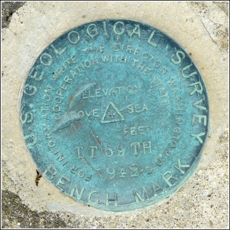
TT 69 TH
TT 69 TH
Spatial/elevation data
| Coordinates | N 41.576492° W 75.760167° |
| Elevation | 1041.975 ft. |
| Location | Pennsylvania
Lackawanna County Factoryville Quad |
Mark description
| Type | Bench Mark Disk |
| Setting | Bridge Abutment |
| Monumented | 1942 by USGS |
| Description (USGS) | Factoryville, 1.7 mi NE. of; in NW. abutment of concrete bridge over Delaware, Lackawanna, and Western Railroad; standard tablet stamped “TT 69 TH 1942” |
Narrative and photographs
Finding this mark was a nice, easy adventure, perfectly suited for a hot (good!) and humid (not so good!) weekend. I first noticed the BM on the topo map last week. It’s not far from the produce stand we visit often in the summer, so I hinted that some day we might combine a trip to the produce stand with a scouting trip for this mark. Today was the day. Rich and I found the mark very easily on the northwest corner of the abutment of the old concrete bridge over the railroad tracks. Weeds are high in August, but it was easy enough to trample them down and take some decent photos of the disk.
The mark is in good condition and seems stable. However, the bridge railings are not in good shape, and I wouldn’t be surprised if the entire bridge is replaced at some point. The nearby Reynolds Road bridge, also in deplorable condition, was demolished in May 2015.
The original description makes no mention of nearby utility pole numbers, but we noted them just in case. The pole directly east of the mark, in front of it if you’re standing on the bridge and looking at the mark, is numbered K-53-KD. A pole several yards northeast of the mark is numbered PP&L Co. 54429 N51979.


