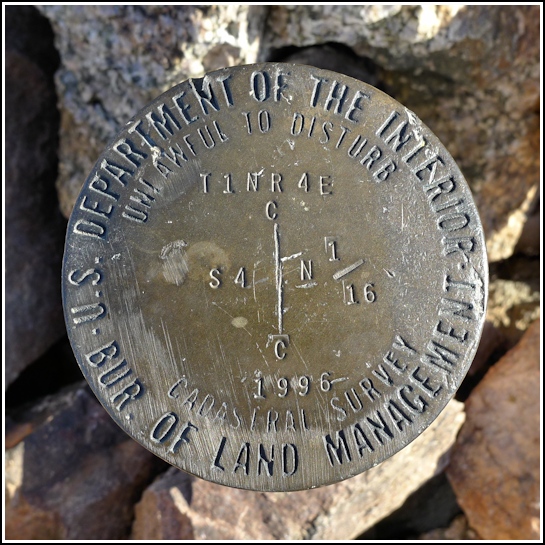
T1NR4E S4 N1/16
T1NR4E S4 N1/16
Recovered in Good Condition on June 5, 2011
Spatial/elevation data
| Coordinates | N 33.4619° W 111.9523° |
| Elevation | Unknown |
| Location | Arizona
Maricopa County Tempe Quad |
Mark description
| Type | Cadastral Survey Disk |
| Setting | Steel Pipe |
| Monumented | 1996 by Bureau of Land Management |
Narrative and photographs
While we were wandering around in Papago Park, we happened to spot this curious pile of stones from a distance. We investigated (of course) and found a section corner disk set on a pipe! It was our first cadastral survey mark (we don’t have these in the eastern states) so it was exciting for that reason alone. And it’s always fun to come across a mark that we weren’t previously aware of. The pipe and disk seem to be in good condition, and it’s very close to several trails and a loop road in the park.

