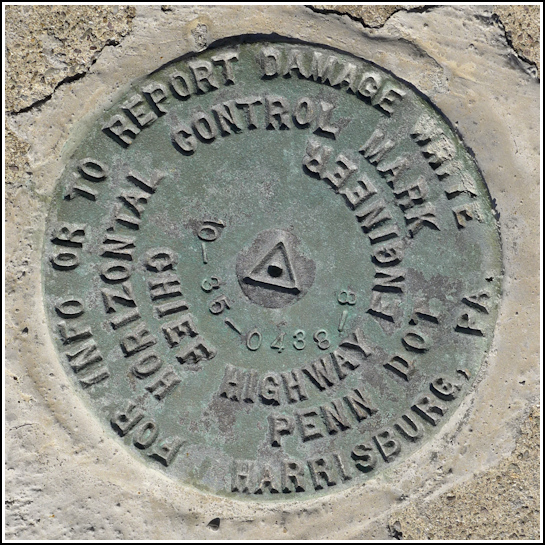
10-35-0438-8
10-35-0438-8
Spatial/elevation data
| Coordinates | N 41.56897° W 75.6327° |
| Elevation | Unknown |
| Location | Pennsylvania
Lackawanna County Dundaff Quad |
Mark description
| Type | Horizontal Control Disk |
| Setting | Concrete Bridge Sidewall |
| Monumented | Unknown by PennDOT |
| Description (PennDOT) | Unavailable. |
Narrative and photographs
We have been so busy moving and working on our house that I hadn’t even yet searched for the nearest benchmarks! I could hardly believe it myself. After a trip to Miller’s Orchard last week, we decided to check the small concrete bridge near the bottom of our road for a PDH mark that is supposed to be set into the southeast wingwall. Well, the bridge is a lot newer than 1943, and now there is no southeast wingwall. But while we were driving by, Rich spotted something benchmark-sized and -shaped on the northwest corner of the bridge, set right on top of the sidewall.
Today was a sunny, windy Fall day, just perfect for exploring the neighborhood. We first explored the several-acre “park” set up by our neighbor Doug. It’s nicer than most town and county parks! Then, still in the mood to walk and soak in the sunshine, we hiked down our hill to investigate the survey mark on the bridge.
It is a standard example of the newer type of PennDOT marks, similar to those we’ve found the last several years in Jessup (96-36-1016-3 and 96-36-1018-4), although this is a horizontal control mark rather than just a survey mark. The mark appears to be in good condition and is set in the west end of the north sidewall of a concrete bridge on Route 438 that passes over the South Branch Tunkhannock Creek. The mark is approximately 6 feet southeast of a utility pole.


