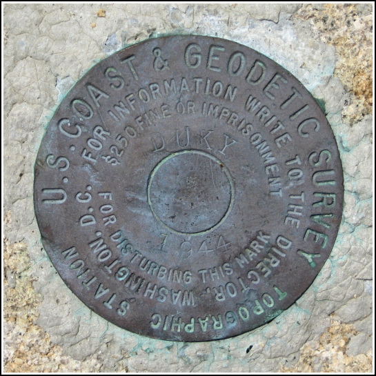
DUKY (PE1910)
DUKY
Spatial/elevation data
| Coordinates | N 44.251766° W 68.4019° |
| Elevation | 3 ft. |
| Location | Maine
Hancock County Bartlett Island Quad |
Mark description
| Type | Topographic Station Disk |
| Setting | Rock Outcrop |
| Monumented | 1944 by NGS |
| Description (NGS) | NGS Datasheet |
NGS recovery information
Descriptive text
Recovered in good condition.Narrative and photographs
After our adventures searching for LOP, we drove directly to Dix Point, also on the southwestern side of the island, to search for DUKY. Similar to LOP, there was a cabin on the point near the mark that we would have to pass by in order to reach the shore. No one appeared to be at home, and no vehicles were parked at the site, so we quickly and quietly sneaked through the woods down to the rock ledges along the shoreline to search for the mark. The adjusted coordinates made this topographic station a quick find—a bit of a shame, really, because this is such a beautiful location! It would be perfect for a picnic lunch and a reading session or a nap in the sunshine. But there’s that problem of trespassing, which we technically were, so we took our photos and left the area without much delay.
I enjoy finding these topographic station marks. They’re out of the ordinary and are also usually in pretty coastal locations. DUKY is in very good condition. I do wonder where the designation came from. There is a Duck Cove nearby, but it’s the next cove to the east (the cove nearest DUKY is Goose Cove).


