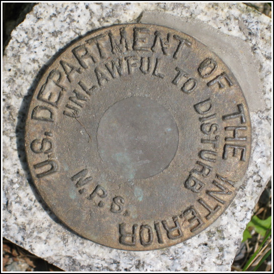
NPS (Unstamped, Acadia #6)
NPS (Unstamped, Acadia #6)
Recovered in Good Condition on June 22, 2008
Spatial/elevation data
| Coordinates | N 44.226516° W 68.338183° |
| Elevation | Unknown |
| Location | Maine
Hancock County Bass Harbor Quad |
Mark description
| Type | Boundary Monument |
| Setting | Granite Monument |
| Monumented | Unknown by National Park Service |
| Description (National Park Service) | Unavailable. |
Narrative and photographs
Our afternoon adventures included finding two topographic station disks (LOP and DUKY) on the western side of the island, and then driving over to Bass Harbor Head to check out the lighthouse and hang out on the rocks for a while. Believe it or not, we found yet another NPS boundary marker on the way! It’s located in the southeast corner of the intersection of Lighthouse Road, which heads south toward the lighthouse, and Arnold Road, heading east. Like many others we’ve found, this NPS disk is unstamped, and is set into the top of a granite post. It is in good condition and is marked by an orange NPS witness post.

