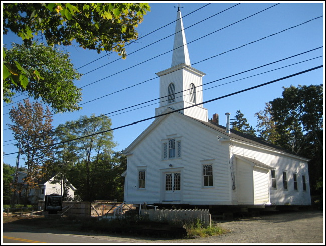
SOUTHWEST HARBOR CHURCH SPIRE (PE1897)
SOUTHWEST HARBOR CHURCH SPIRE
Recovered in Destroyed Condition on September 12, 2007
Spatial/elevation data
| Coordinates | N 44.265899° W 68.309531° |
| Elevation | Unknown |
| Location | Maine
Hancock County Southwest Harbor Quad |
Mark description
| Type | Landmark/Intersection Station |
| Setting | Church Spire |
| Monumented | Unknown by NGS |
| Description (NGS) | NGS Datasheet |
NGS recovery information
Descriptive text
Recovered in destroyed condition.Narrative and photographs
What could be better than hunting a benchmark after indulging in lobster?! We enjoyed both activities today while spending time in Southwest Harbor.
This was just a landmark station, but it turned out to be more interesting than I’d expected. We arrived at the church (now called the Manset Union Church) to discover that the entire structure had been moved from its foundation! Construction work is underway. We suspect that the building will be returned to its original location (approximately) once the new foundation is complete, but the mark will still probably be considered Destroyed due to the movement.

