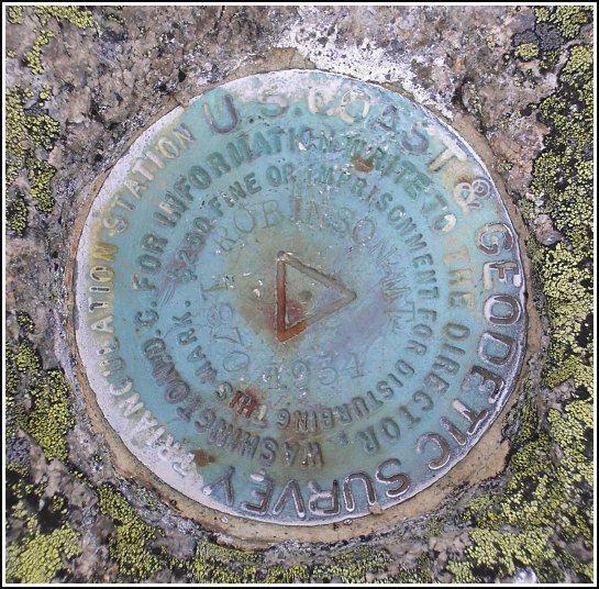
ROBINSON MOUNTAIN 1870 (PE1895)
ROBINSON MOUNTAIN 1870
Spatial/elevation data
| Coordinates | N 44.323967° W 68.31763° |
| Elevation | 696 ft. |
| Location | Maine
Hancock County Southwest Harbor Quad |
Mark description
| Type | Triangulation Station Disk |
| Setting | Bedrock |
| Monumented | 1870 by NGS |
| Description (NGS) | NGS Datasheet |
NGS recovery information
Descriptive text
The station mark and both reference marks were recovered in good condition as described.Narrative and photographs
We began our hike early on a damp, extremely foggy morning. The views on the way up may not be the most spectacular the island has to offer, but I still think the Acadia Mountain Trail has made its way onto my list of favorites. Numerous steep sections and rock scrambles kept the hike challenging and interesting, and the views we discovered once we reached the great ledges near the tri-station were a perfectly relaxing reward after such exertion. The sun finally came out while we were documenting the marks. With so little information available to lead us to the reference marks I was concerned we might not find them, but they are both within a few meters of the station, and are easy to spot on the bare rock ledge. We found the station and both reference marks to be in fine condition.


| Designation | Status | Condition | Image |
|---|---|---|---|
| ROBINSON MOUNTAIN 1870 RM 1 | Recovered | Good |
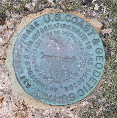
|
| ROBINSON MOUNTAIN 1870 RM 2 | Recovered | Good |
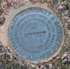
|