ROBINSON MOUNTAIN 1870 (PE1895)
ROBINSON MOUNTAIN 1870
Note Entered on September 7, 2013
Previous recovery (June
25, 2006)
Spatial/elevation data
| Coordinates | N 44.323967° W 68.31763° |
| Elevation | 696 ft. |
| Location | Maine
Hancock County Southwest Harbor Quad |
Mark description
| Type | Triangulation Station Disk |
| Setting | Bedrock |
| Monumented | 1870 by NGS |
| Description (NGS) | NGS Datasheet |
Narrative and photographs
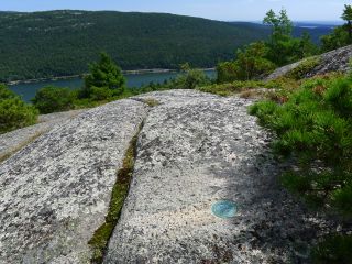
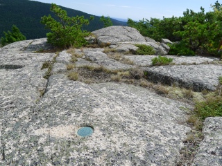
During today’s hike to both summits of Acadia Mountain, we made a quick search for ROBINSON MOUNTAIN 1870 (which we had found in 2006, but we didn’t recall it having been such a struggle to get to then)! We eventually made our way to the correct ledge—peaceful location overlooking Somes Sound—and found all three marks still in perfect condition. The triangulation station is off the trail and requires some light bushwhacking to reach it.
 Mountain")

| Designation | Status | Condition | Image |
|---|---|---|---|
| ROBINSON MOUNTAIN 1870 RM 1 | Note Entered | Good |
|
| ROBINSON MOUNTAIN 1870 RM 2 | Note Entered | Good |
|