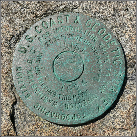
HULL 1944 (PE1804)
HULL 1944
Recovered in Good Condition on September 17, 2007
Spatial/elevation data
| Coordinates | N 44.40975° W 68.24045° |
| Elevation | 3 ft. |
| Location | Maine
Hancock County Bar Harbor Quad |
Mark description
| Type | Topographic Station Disk |
| Setting | Rock Outcrop |
| Monumented | 1944 by NGS |
| Description (NGS) | NGS Datasheet |
NGS recovery information
Descriptive text
Station recovered in good condition. It is located on a rocky point known as Canoe Point.Narrative and photographs
This was a fun mark to find, and it’s in such a beautiful location! Like a few others in this area, HULL is a topographic disk, something a little different from the majority of marks we find. This one also had us wandering around on private property belonging to the Bar Harbor Yacht Club—fortunately we didn’t need to go anywhere near their facilities and were able to walk out to Canoe Point through the woods without any problems. The disk is in very good condition and is set into a nice smooth rocky ledge that would be perfect for a picnic overlooking the bay.


