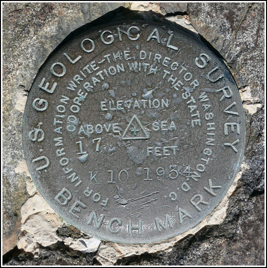
K 10
K 10
Recovered in Good Condition on September 17, 2007
Spatial/elevation data
| Coordinates | N 44.416016° W 68.250783° |
| Elevation | 17.035 ft. |
| Location | Maine
Hancock County Salsbury Cove Quad |
Mark description
| Type | Bench Mark Disk |
| Setting | Rock Outcrop |
| Monumented | 1934 by USGS |
| Description (USGS) | Hulls Cove Post Office, 0.15 mi. N. toward, in ledge jutting out into cove, 75 ft. E. of rd.; standard disk stamped “K-10-1934” “P.B.M. 17.1” on ledge. R.M., 25 ft. N. of tablet, on point of ledge jutting out into cove, 75 ft. E. of rd., 25 ft. N. of P.B.M.; chiseled square “R.M.” on ledge (elev. 14.40 ft.) |
Narrative and photographs
On a morning filled with benchmark explorations, we stopped at the Hull’s Cove beach across Route 3 from the Colony Motel to search for K 10. It’s a USGS benchmark that we’ve known about for a while (since we received the USGS datasheets) but today was our first good opportunity to search for it. We found it in excellent condition, just as described, on the high rock ledge. We did not see the “P.B.M. 17.1” on the ledge (if it was painted, the paint is probably long gone). We also did not find the chiseled square that served as the RM, but we would like to come back to search for it again.


