HADLEYS POINT (PE1884)
HADLEYS POINT
Spatial/elevation data
| Coordinates | N 44.438667° W 68.3177667° |
| Elevation | 161 ft. |
| Location | Maine
Hancock County Salsbury Cove Quad |
Mark description
| Type | Triangulation Station Disk |
| Setting | Rock Outcrop |
| Monumented | 1865 by NGS |
| Description (NGS) | NGS Datasheet |
NGS recovery information
Descriptive text
The station and both reference marks were recovered in good condition, as described in the 1979 recovery. To reach the station from the junction of Route 1a and Route 3 in Ellsworth, drive south on Route 3 approximately 9.5 miles, crossing the bridge onto Mount Desert Island. At the traffic light continue (bear left) on Route 3 for 3 miles to Hadley’s Point Road. Turn left onto Hadley’s Point Road and travel 0.3 miles to a cemetery on the left. Walk southwest approximately 450 feet through the cemetery and an open field to the station just inside a wooded area. Autonomous (non-corrected) handheld GPS coordinates for RM 1 are 44 26 19.9(N) 068 19 03.5(W). Autonomous (non-corrected) handheld GPS coordinates for RM 2 are 44 26 19.8(N) 068 19 04.6(W).Narrative and photographs
After our very exciting find of a station that had been considered lost for 73 years (nearby RICHARDS 1865) we just had to stop for one more before heading home. HADLEYS POINT was a great choice because it’s so close to RICHARDS, and was another very old station that we had been interested in for some time. This station was last recovered in 1979, so it’s been a while since this station was visited, and we hoped to be able to provide an update.
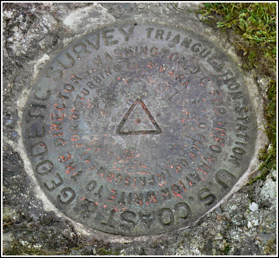
While this station is very close to the campgrounds at Hadley’s Point, it’s technically on private property. At no time did we feel like anyone would give us any trouble for poking around there, though. The station mark was an easy find, set in a rock outcrop at the base of a tree. It is a standard disk rather than a bolt, as noted in the 1979 description. From the stamping on the disk (HADLEYS POINT 1865 1934), it appears that the bolt was replaced by the disk in 1934, but curiously the 1934 description mentions the bolt and does not say anything about replacing it with a disk.
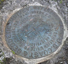
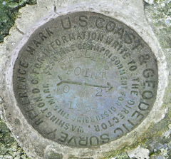
Both reference marks are set on large boulders in a wooded area near the station. They were easy to find and are also in good condition.
There is an old foundation near the station and for a few minutes, I wondered if it might have marked the site of Abraham Richardson’s house mentioned in the 1865 description. It’s in the wrong direction from the mark, so I assume it was not the same building, but it nevertheless lent an interesting historical aspect to this hunt! If only we could find out what it was.


| Designation | Status | Condition | Image |
|---|---|---|---|
| HADLEYS POINT RM 1 | Recovered | Good |
|
| HADLEYS POINT RM 2 | Recovered | Good |
|