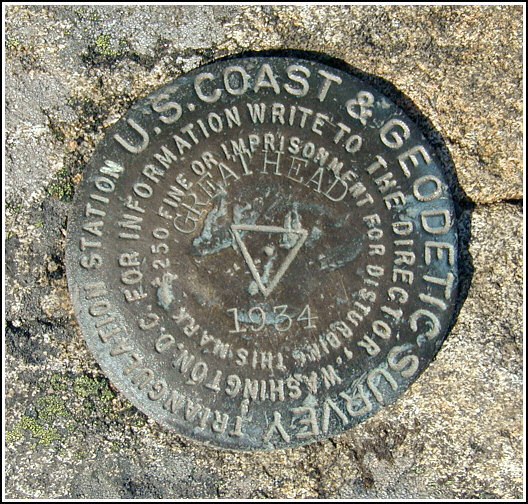
GREAT HEAD (PE1783)
GREAT HEAD
Recovered in Good Condition on June 9, 2005
Spatial/elevation data
| Coordinates | N 44.3285° W 68.174333° |
| Elevation | 144 ft. |
| Location | Maine
Hancock County Seal Harbor Quad |
Mark description
| Type | Triangulation Station Disk |
| Setting | Bedrock |
| Monumented | 1934 by NGS |
| Description (NGS) | NGS Datasheet |
NGS recovery information
Descriptive text
(Reported to NGS 9/13/2011) The station and both reference marks were recovered in good condition. The marks are in Acadia National Park. They are easily reached via the Great Head Trail beginning either at Sand Beach or at the parking area along Schooner Head Road. Handheld GPS coordinates for RM 1 are 44 19 42.6(N) 068 10 27.5(W). Handheld GPS coordinates for RM 2 are 44 19 42.6(N) 068 10 27.7(W).Narrative and photographs
Our first day in Acadia was lovely, sunny and hot. Immediately after arriving and getting settled, Rich took us on an afternoon hike to Great Head, a most scenic spot to begin our vacation. All three marks in this set are in good condition and are easy to find as described.
No report was submitted to NGS at this time; the most recent report was less than a year ago, and the condition of the mark has not changed in the meantime.
UPDATE: Photographs of GREAT HEAD by Rich and me are featured in the book Lasting Impressions: A Glimpse into the Legacy of Surveying, Rhonda Rushing, Berntsen International, Inc., 2006.
UPDATE: Rich and I were married at this survey station on September 13, 2011!


, RM 1 (white), and RM 2 (turquoise).")
| Designation | Status | Condition | Image |
|---|---|---|---|
| GREAT HEAD RM 1 | Recovered | Good |
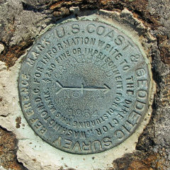
|
| GREAT HEAD RM 2 | Recovered | Good |
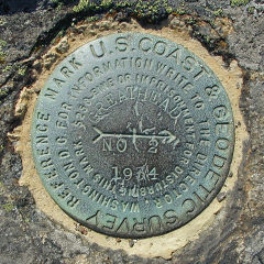
|