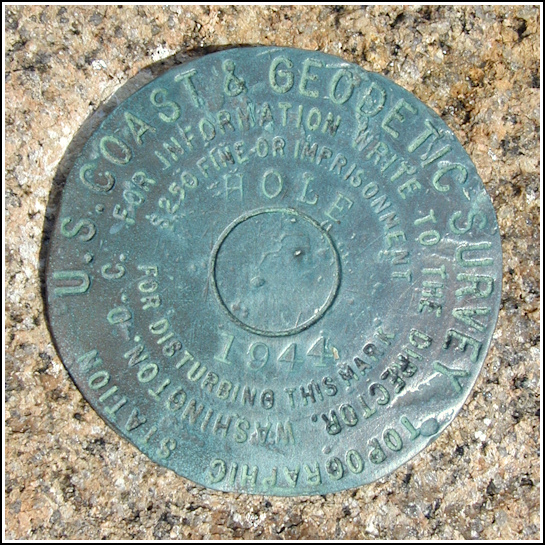
HOLE
HOLE
Spatial/elevation data
| Coordinates | N 44.320516° W 68.188333° |
| Elevation | Unknown |
| Location | Maine
Hancock County Bar Harbor Quad |
Mark description
| Type | Topographic Station Disk |
| Setting | Rock Outcrop |
| Monumented | 1944 by NGS |
| Description (NGS) | Unavailable. |
Narrative and photographs
It’s only our second day in Acadia, and already I’ve seen so much beauty I can barely comprehend it all! And to top it off, Rich had another surprise up his sleeve—a topographic station on a seastack above Thunder Hole (appropriately named HOLE) that he found during his last visit in 2002. I couldn’t wait to see it for myself. A quick scramble up the side of the seastack and then venturing close to the sea-facing edge brought me right to the disk. “Breathtaking spot” doesn’t come close to describing this place. I could sit up here all afternoon, teased by the winds and sea spray, watching and listening to the activity below, of humans, gulls, and the waves crashing into Thunder Hole and then being sucked back out to sea.
I haven’t been able to find any more information about this disk. so all we have is the type of station and the date it was set (1944). The disk is in good condition and I hope it remains so for a long time to come.


