TIDAL 30 STA 30 (PE0381)
TIDAL 30 STA 30
Spatial/elevation data
| Coordinates | N 44.469617° W 68.8107° |
| Elevation | 8.32 ft. |
| Location | Maine
Waldo County Castine Quad |
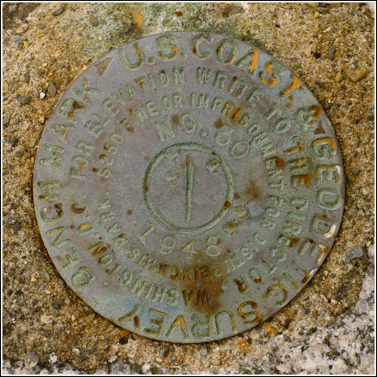
Mark description
| Type | Tidal Bench Mark Disk |
| Setting | Boulder |
| Monumented | 1948 by NGS |
| Description (NGS) | NGS Datasheet |
NGS recovery information
Descriptive text
Recovered in good condition in a large boulder along the shoreline at Fort Point State Park. The trail described in the original recovery note can no longer be distinguished but several other trails lead down to the rocky shoreline. The mark is about 750 ft. (228.6 m) southeast of TIDAL 2 STA 30 (PE0383).Narrative and photographs
Our third visit to Fort Point had a very specific purpose: to try to locate TIDAL 30 STA 30, which we had searched for unsuccessfully in the past. The datasheet description isn’t helpful, mainly because it bases its measurements on an old trail to the lighthouse. No sign of this trail exists now.
A few weeks ago I happened to notice that a geocacher had logged PE0383, the mark on the boulder that we found last year. In disbelief I took a closer look at his log. His closeup photo of the disk showed that he had not found PE0383, but he had found PE0381 (TIDAL 30 STA 30)! We put the mark on our list of possibilities for this year, noting the coordinates he had provided.
The tide was coming in when we arrived in mid-morning, but there was still enough shoreline for us to walk on. We walked a few hundred yards, hopping from rock to rock, through buggy grass along the shoreline and came to a large boulder. From a few yards away we could see the familiar round shape of a disk set in the top of the boulder. Sure enough, it was TIDAL 30 STA 30! We were within 45-50 feet of the geocacher’s coordinates; I’m thankful that they were reliable enough to lead us right to the area. I documented the mark and we headed back, having experienced enough bug bites for one morning.

