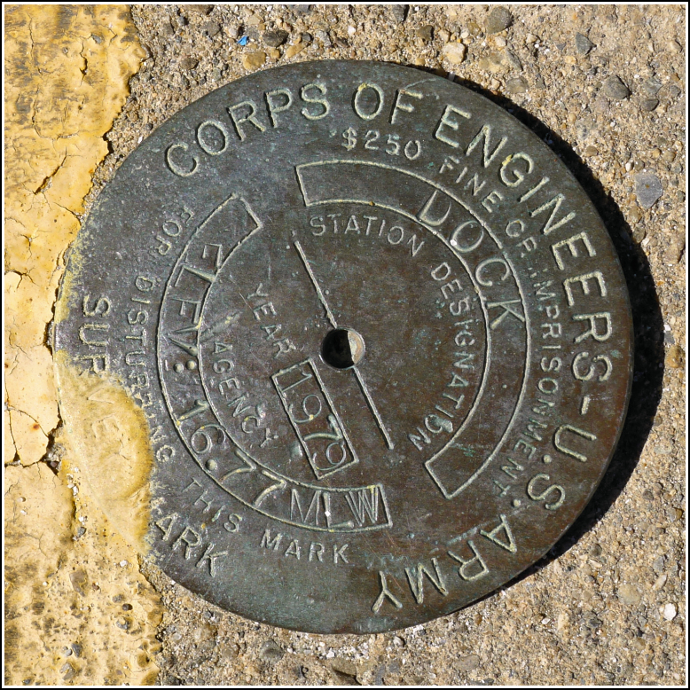
DOCK
DOCK
Recovered in Good Condition on September 15, 2015
Spatial/elevation data
| Coordinates | N 44.29475° W 68.2846° |
| Elevation | 16.77 MLW |
| Location | Maine
Hancock County Southwest Harbor Quad |
Mark description
| Type | Survey Mark |
| Setting | Concrete Pier |
| Monumented | 1979 by Army Corps of Engineers |
Narrative and photographs
We spotted this Army Corps survey mark after a cruise with Dad to the Cranberry Isles. As we were heading off the pier toward the parking lot, Rich and I simultaneously noticed the disk. “You know what you have to do!” he said, referring to the usual documenting of the mark. We’ve been to Northeast Harbor plenty of times before and I thought we had checked the piers for benchmarks—but since this mark has apparently been in place since 1979, I guess we just missed it. It’s in excellent condition and is clearly stamped with the elevation in feet above Mean Low Water datum.

