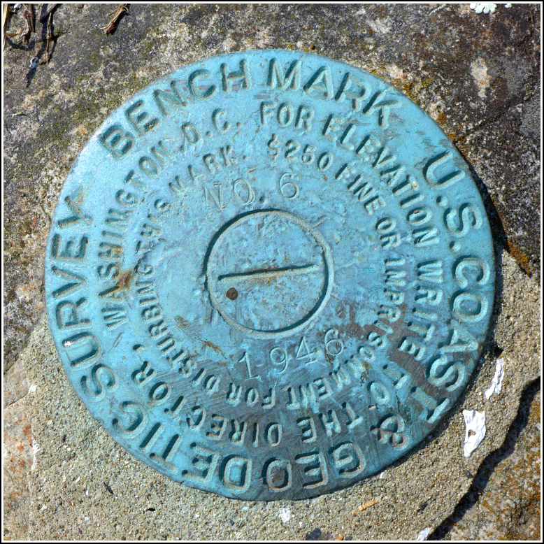
TIDAL 6 STA 13
Recovered in Good Condition on September 17, 2017
Spatial/elevation data
| Coordinates | N 44.24075° W 68.352825° |
| Elevation | 20.29 ft. |
| Location | Maine
Hancock County Bass Harbor Quad |
Mark description
| Type | Tidal Bench Mark Disk |
| Setting | Rock Outcrop |
| Monumented | 1946 by NGS |
| Description (NGS) | NGS Datasheet |
NGS recovery information
Descriptive text
Recovered in good condition as described. The road leading to the wharf is called Rice Road.Narrative and photographs
See also: Shared Solution for TIDAL 6 STA 13
This mark was an easy find, and easy to access because it’s so close to a parking area. It’s set into a small outcrop in a narrow area of grass northwest of a parking lot for a wharf. The disk is in good condition. Rich and I came here after a lobster lunch in Southwest Harbor in search of this mark and another mark in this tidal series, TIDAL 4, which is just a few hundred feet north on another ledge.

