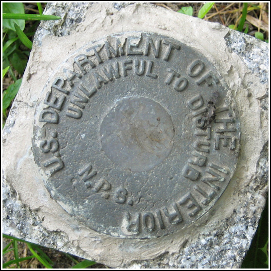
NPS (Unstamped, Acadia #1)
NPS (Unstamped, Acadia #1)
Recovered in Good Condition on June 23, 2006
Spatial/elevation data
| Coordinates | N 44.372683° W 68.1957° |
| Elevation | Unknown |
| Location | Maine
Hancock County Bar Harbor Quad |
Mark description
| Type | Boundary Monument |
| Setting | Square Concrete Monument |
| Monumented | Unknown by National Park Service |
| Description (National Park Service) | Unavailable. |
Narrative and photographs
On a misty Friday morning, we set out to explore trails Rich had noticed on the map near Bar Harbor. We noticed that there was a small area of designated park land here by Dorr Point, but Rich had never walked the trails and in fact knew nothing about them. We overshot the parking area initially, and when turning around in the next street we encountered (Old Farm Road), I saw the bright orange witness post. I looked down quickly and spotted a small concrete monument and the unmistakable shape of a disk! We returned to the area to document our find after hiking around the point and exploring the ruins of George Dorr’s estate (“Old Farm”). This NPS boundary disk appears to be in good condition, but has no stamped designation or date.


