ROAR 2
Spatial/elevation data
| Coordinates | N 41.41042° W 75.595415° |
| Elevation | 1425 ft. |
| Location | Pennsylvania
Lackawanna County Olyphant Quad |
Mark description
| Type | Triangulation Station Disk |
| Setting | Rock Outcrop |
| Monumented | 1973 by NGS |
| Description (NGS) | NGS Datasheet |
NGS recovery information
Descriptive text
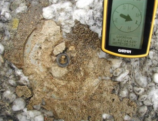
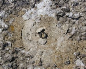
Disk missing, shank still in place. Reference marks 3, 4 and 5 are still in place in good condition.Narrative and photographs
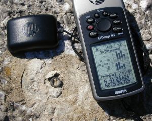
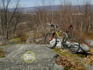
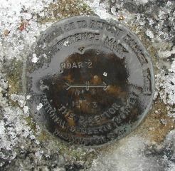
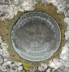
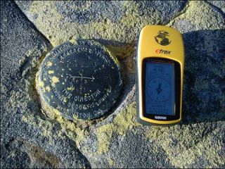
With some hesitation I’m marking this as Found, though in very poor condition. At the coordinates (which I trust since the location is described as ‘adjusted’) I found the stem of a benchmark disk embedded in the rock, and the round impression in the concrete, but the cap of the marker is missing. Reference marks 3 and 4 were found as described and in very good condition. I located reference mark 5 (across the highway!) last year and it is logged separately. The old dead tree that held the witness sign is gone, though its approximate location can be determined from other information given in the description (I believe the description errs in saying that reference mark 3 is 45 feet northwest, rather than northeast, of the witness sign.) All other distances and directions are as described.
(Recovered on April 13, 2003)
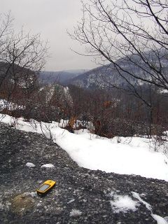
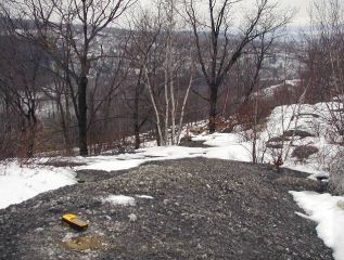
This triangulation station is about ½ mile to the south-southeast of the Holiday Inn on Tigue Street. It can be reached by following the paved dead-end road to an iron gate and then left along the edge of an open field to a promontory of conglomerate outcroppings. (My goal today was to bike over from home, find the station and then poke around on some of the other trails. Lots of good mountain biking in the area and you can even reach the “Edge of a Ledge” Geocache this way.) The historic descriptions lead only roughly to the locations for all three marks since the witness sign no longer exists. At the station mark my Garmin GPSmap76 receiver indicated 6.1 feet from the NGS datasheet coordinates. The disk has been mutilated (as noted by Zhanna in the previous log) and only the stem remains embedded in the slab. The two reference discs are in very good condition, well exposed, and the stamped designations are legible. A third reference mark for this station (LY2715) is listed separately in the NGS database. ~Rich in NEPA~
[Edit Note: The criterion for logging this recovery as “Found” is positive identification, since the reference marks are all intact and provide sufficient evidence of the station’s exact location and identity. Also, the station is not being listed as “Destroyed” because it is still viable in spite of the missing marker. Its condition is described only as “Poor” pending final determination by NGS.]
| Designation | Status | Condition | Image |
|---|---|---|---|
| ROAR 2 RM 3 | Recovered | Good |
|
| ROAR 2 RM 4 | Recovered | Good |
|
| ROAR 2 RM 5 | Recovered | Good |
|
