ROAR 2 RM 5 (LY2715)
Spatial/elevation data
| Coordinates | N 41.402616° W 75.598266° |
| Elevation | 1461 ft. |
| Location | Pennsylvania
Lackawanna County Olyphant Quad |
Mark description
| Type | Reference Mark Disk |
| Setting | Rock Outcrop |
| Monumented | 1973 by NGS |
| Description (NGS) | NGS Datasheet |
NGS recovery information
Descriptive text
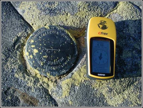
Reference mark 5 recovered in good condition. The witness post no longer exists.Narrative and photographs
For more information about this reference mark, see its parent mark ROAR 2.
Found it! Actually, I found it a while ago, but I wanted to come back for photos of the area. Of course, I had to pick a miserable rainy day. This is a pretty bleak spot anyway, but it’s close to my house so I just had to run up and check for the marker. It is in good condition and was easy to find because my GPSr brought me within a few feet of it.


(Recovered on April 21, 2003)
This reference mark (which is part of triangulation station LY2714 “ROAR 2”) is about 1.35 miles east along Elmhurst Blvd from the intersection with Lake Scranton Rd. The historic description leads reliably to the site except that the witness sign no longer exists. At the station mark my Garmin GPSmap76 receiver indicated 4.6 feet from the NGS datasheet coordinates. The disk is in very good condition, well exposed, and the stamped designations are legible. ~Rich in NEPA~


