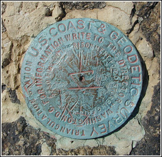
BUTTER HILL RESET (LY2493)
BUTTER HILL RESET
Spatial/elevation data
| Coordinates | N 41.427116° W 74.0013° |
| Elevation | 1381 ft. |
| Location | New York
Orange County Cornwall Quad |
Mark description
| Type | Triangulation Station Disk |
| Setting | Rock Outcrop |
| Monumented | 1933 by NGS |
| Description (NGS) | NGS Datasheet |
NGS recovery information
Descriptive text
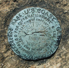
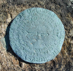
The station mark and reference marks 1 and 2 were recovered in fair condition as previously described. Route 9W is now divided and the parking area cannot be accessed from the eastbound lanes. The trail is now marked with orange blazes.Narrative and photographs
Our trip to Storm King was the second in our late-Summer series of day trips to the Hudson Valley region. The orange/yellow trail climbs very steeply from near the parking area on Route 9W, and it took us to a rock ledge overlooking the highway. From there we headed steeply upward again and soon came across three stone pillars and part of a granite foundation—ruins of Spy Rock House, according to our hike description. What a place for a Summer home!
Our next stop was the summit of Butter Hill. I was unprepared for the sight. The 360° views make this a perfect spot for a triangulation station, and just a very inspirational place overall. We recovered the station and both reference marks with ease, took our time photographing the marks and the scenery, and then looked for the nearby geocache “Butter Hill South”.


| Designation | Status | Condition | Image |
|---|---|---|---|
| BUTTER HILL RESET RM 1 | Recovered | Good |
|
| BUTTER HILL RESET RM 2 | Recovered | Good |
|