BURNETT (KU4050)
BURNETT
Spatial/elevation data
| Coordinates | N 40.976616° W 73.909133° |
| Elevation | 499 ft. |
| Location | New Jersey
Bergen County Yonkers Quad |
Mark description
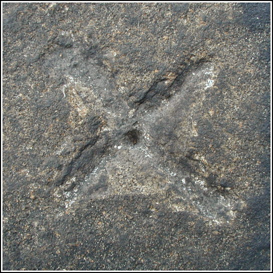
| Type | Chiseled Cross |
| Setting | Rock Outcrop |
| Monumented | 1930 by NGS |
| Description (NGS) | NGS Datasheet |
NGS recovery information
Descriptive text
This station is now on Palisades Interstate Park property and is accessible via park trails. The green-painted house near the station no longer exists. The Glenwood Power Station stacks can still be viewed from this station.Narrative and photographs
Rich and I had a few tri-stations in mind as possible diversions on our day-trip to the Palisades, but the main goal of the day was just hiking and exploring. We followed the “low road” south and eventually circled back using the trails on top of the cliffs, finding several caches along the way. On our leisurely hike back to the car we made our way out each and every little trail we encountered, to every overlook we could find. Eventually we found ourselves very close to the coordinates for BURNETT. Despite some slight trepidation, we climbed through the fence and out onto the cliff. We found the drill hole and chiseled cross immediately. The mark itself appears to be in fine condition, though we were unable to locate any of the reference landmarks other than the power station. This is one of our most scenic benchmark finds to date.


