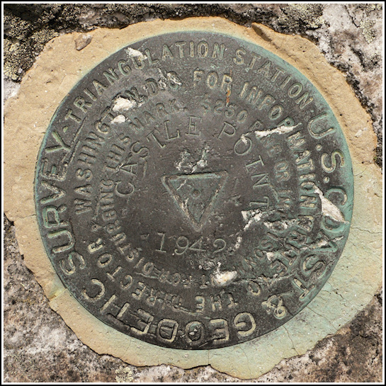
CASTLE POINT (LY2465)
CASTLE POINT
Recovered in Good Condition on May 22, 2009
Spatial/elevation data
| Coordinates | N 41.7031° W 74.2733° |
| Elevation | 2192 ft. |
| Location | New York
Ulster County Napanoch Quad |
Mark description
| Type | Triangulation Station Disk |
| Setting | Bedrock |
| Monumented | 1942 by NGS |
| Description (NGS) | NGS Datasheet |
NGS recovery information
Descriptive text
The station and reference marks 1 and 2 were recovered in good condition. The marks are located in Minnewaska State Park Preserve, on a high ledge along the Blueberry Run Path near its intersection with the Castle Point Carriageway. Autonomous (non-corrected) handheld GPS coordinates for RM 1 are 41 42 11.5(N) 074 16 23.3(W). Autonomous (non-corrected) handheld GPS coordinates for RM 2 are 41 42 11.3(N) 074 16 24.5(W).Narrative and photographs
Our goal for today was to ride the carriage trails at Minnewaska State Park, and along our route to recover the CASTLE POINT triangulation station at (unsurprisingly) Castle Point. The Castle Point carriageway contains a long, gradual climb of about three miles but with plenty of overlooks along the way, of which we took full advantage. Once we reached the ledges at Castle Point, finding the triangulation station and associated reference marks was simple. The Blueberry Run Path basically passes right over the station, and the reference marks were well exposed and exactly where the datasheet specified they would be. All disks are in good condition.


| Designation | Status | Condition | Image |
|---|---|---|---|
| CASTLE POINT RM 1 | Recovered | Good |
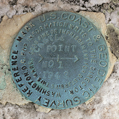
|
| CASTLE POINT RM 2 | Recovered | Good |
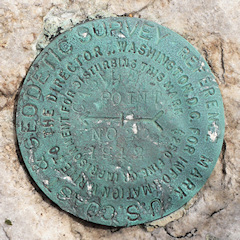
|