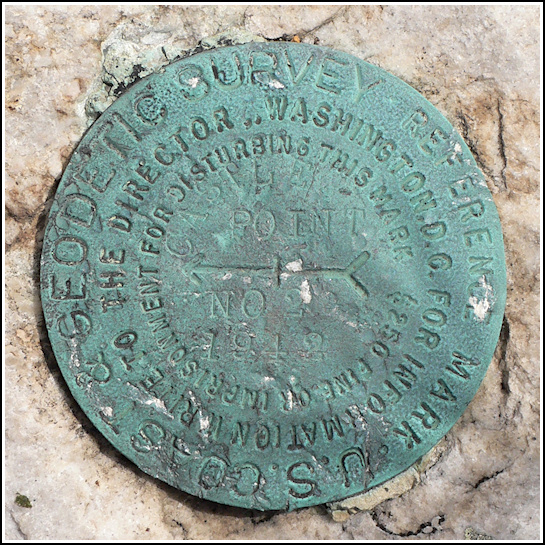
CASTLE POINT RM 2
Recovered in Good Condition on May 22, 2009
Spatial/elevation data
| Coordinates | N 41.703133° W 74.273483° |
| Elevation | Unknown |
| Location | New York
Ulster County Napanoch Quad |
Mark description
| Type | Reference Mark Disk |
| Setting | Bedrock |
| Monumented | 1942 by NGS |
Narrative and photographs
For more information about this reference mark, see its parent mark CASTLE POINT.

