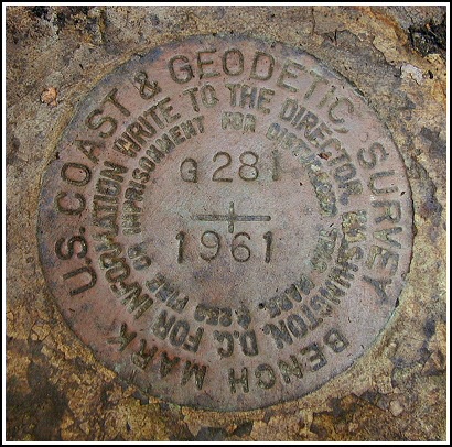
G 281 (LY1600)
G 281
Spatial/elevation data
| Coordinates | N 41.3542° W 75.581616° |
| Elevation | 1621.47 ft. |
| Location | Pennsylvania
Lackawanna County Moscow Quad |
Mark description
| Type | Bench Mark Disk |
| Setting | Boulder |
| Monumented | 1961 by NGS |
| Description (NGS) | NGS Datasheet |
Narrative and photographs
We were in the area and had time after locating LY1599 to search for one more benchmark. After locating the proper gravel road (Old Saw Mill Road, as Rich noted), it was a simple task to find the large boulder in the wooded area east of the gravel road. The disk is now cleared of dirt and moss and it is in very good condition.

This vertical control station is located on the top surface of a very large boulder roughly 120 feet south-southeast from the intersection of Blue Shutters Road and Old Saw Mill Road, a dirt track leading south. It’s easier to walk a few dozen yards along the dirt track and then turn directly into the woods to the left (east). The historical description leads reliably to the station, but the mark was concealed by a layer of moss. The surface of the rock around the mark was scraped clean as best as possible and the disk is now well exposed. At the station a Garmin GPSmap76 receiver indicated 44 feet from the scaled NGS datasheet coordinates. The disk is in very good condition and the stamped designation is legible. ~Rich in NEPA~


