F 400 (LY2402)
F 400
Spatial/elevation data
| Coordinates | N 41.949417° W 75.597033° |
| Elevation | 1039.78 ft. |
| Location | Pennsylvania
Susquehanna County Susquehanna Quad |
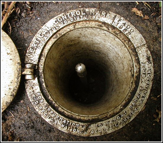
Mark description
| Type | Vertical Control Mark |
| Setting | Steel Rod |
| Monumented | 1982 by NGS |
| Description (NGS) | NGS Datasheet |
Narrative and photographs
This mark is located near the intersection of Route 171 and East Church Street (the “paved road leading southwest” mentioned in the description). It was fortunate that I needed to turn around and pulled up onto East Church Street in order to do so; it was then that I happened to notice the NGS witness post. The mark was easy to find following the description as it’s located less than three feet northeast of the post. The “Welcome to Susquehanna” sign no longer exists, but the rusting supports are still in place and also served to help locate the station. The utility pole still exists and is numbered 4S-355. The station is a rod inside a pipe with an access hatch; the hatch is flush with the surface of the ground. The station appears to be in good condition. At the site, my GPS receiver indicated coordinates approximately 90 feet from the coordinates given on the datasheet.


