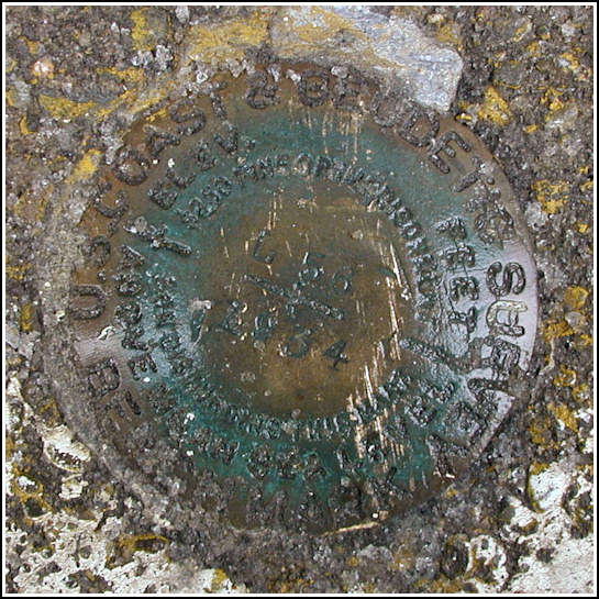
L 56 (LY1434)
L 56
Spatial/elevation data
| Coordinates | N 41.251366° W 75.883883° |
| Elevation | 545.86 ft. |
| Location | Pennsylvania
Luzerne County Wilkes Barre West Quad |
Mark description
| Type | Bench Mark Disk |
| Setting | Bridge Bannister |
| Monumented | 1934 by NGS |
| Description (NGS) | NGS Datasheet |
Narrative and photographs
Rich told the story well! I have very little to add except that I was surprised and pleased by the way the construction workers aided us without even asking our purpose. It’s encouraging to discover that people still exist who know how to mind their own business. And they even pointed out a few other benchmarks in the area! What a fun morning.
N 41° 14.892’ W 075° 53.072’
While hunting a Geocache at Kirby Park it was a short walk across the West Market Street bridge to search for this station mark. The historic description leads to the correct location. The disc was buried under a thick layer of ice and snow and, with the use of a shovel borrowed from a helpful construction worker nearby, finding it was not at all difficult. At the station mark my Garmin GPSmap76 receiver indicated 111 feet from the posted coordinates, but because satellite signals were partially blocked on two sides by the granite balustrade the coordinates I recorded should be used only as a guide. The disc is in very good condition and the stamped designation is legible. ~Rich in NEPA~


