19126 (LY1334)
19126
Recovered in Good Condition on August 31, 2002
Spatial/elevation data
| Coordinates | N 41.40795° W 75.662716° |
| Elevation | 753.15 ft. |
| Location | Pennsylvania
Lackawanna County Scranton Quad |
Mark description
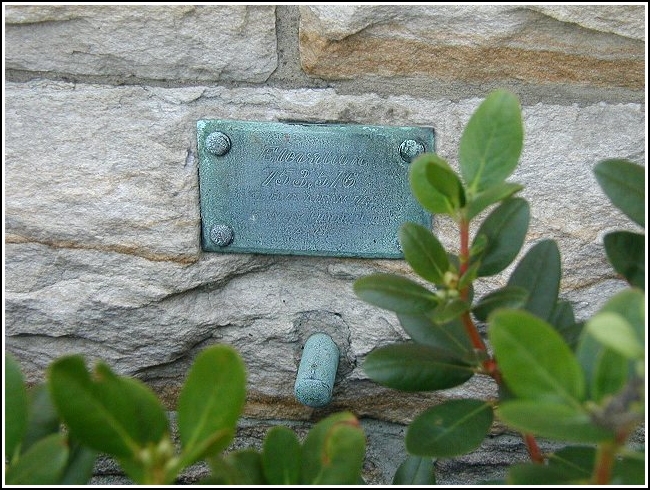
| Type | Copper Bolt |
| Setting | Stone Building |
| Monumented | Unknown by Central Railroad of New Jersey |
| Description (NGS) | NGS Datasheet |
NGS recovery information
Descriptive text
Recovered in good condition on the county courthouse building as described. Handheld GPS coordinates for the mark are 41 24 28.6(N) 075 39 45.8(W).Narrative and photographs
I wandered down to the Italian festival, right on Courthouse Square, this evening for dinner and to get a photo of this plaque and bolt! It was a challenge because so many people were milling about. Probably no one noticed me leaning over the bushes and taking photos of the side of the courthouse wall; weirder things are seen here every day at lunchtime. The elevation according to my GPS was 780 ft.

