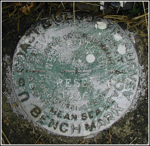
WEST PITTSTON RESET 1935 (LY1325)
WEST PITTSTON RESET 1935
Recovered in Good Condition on June 13, 2003
Spatial/elevation data
| Coordinates | N 41.327166° W 75.7979° |
| Elevation | 561.5 ft. |
| Location | Pennsylvania
Luzerne County Pittston Quad |
Mark description
| Type | Survey Disk |
| Setting | Concrete Base |
| Monumented | 1935 by Local Engineer |
| Description (NGS) | NGS Datasheet |
NGS recovery information
Descriptive text
Recovered in good condition. The description is accurate, but the disk is stamped RESET 1936 rather than RESET 1935. Handheld GPS coordinates for the bench mark are 41 19 37.8(N) 075 47 52.4(W).Narrative and photographs
This benchmark was found as described except that the stamping indicates “Reset 1936” instead of “Reset 1935”. The disk is in good condition, and the description led directly to the site. In the third photo, Linden Street can be seen in front of the Valley Masonic Hall, while Berry Street runs along the Hall’s southwest edge.


