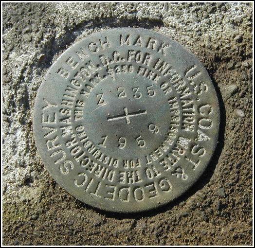
Z 235 (LY1235)
Z 235
Spatial/elevation data
| Coordinates | N 41.464533° W 75.126816° |
| Elevation | 834.11 ft. |
| Location | Pennsylvania
Pike County Hawley Quad |
Mark description
| Type | Bench Mark Disk |
| Setting | Bridge Wingwall |
| Monumented | 1959 by NGS |
| Description (NGS) | NGS Datasheet |
Narrative and photographs
We traveled north along Decker Hollow Road (past the site of the elusive LY1233 - X 235) to Kimbles to continue our search for the 235 series marks. This mark required no searching. As described, it’s set in the northwest wingwall of the north abutment of a concrete bridge along T495, less than 200 feet south-southeast of the intersection of Decker Hollow Road and T495. The mark is in good condition with legible stamping.


N 41° 27.872’ W 075° 07.609’
Recovered in good condition.
This second order vertical control station is set in the top of the northwest wingwall for the north abutment of a bridge along Hendershot Road (T495) which spans Decker Creek. The historical description leads reliably to the station. At the station a Garmin GPSmap76 receiver with remote active antenna was used to record WAAS-corrected coordinates which were 51 feet from the scaled coordinates listed in the NGS datasheet. The mark is well exposed, in good condition, and the stamped designation is legible. ~Rich in NEPA~


