W 235 (LY1231)
W 235
Spatial/elevation data
| Coordinates | N 41.429566° W 75.138733° |
| Elevation | 1298.35 ft. |
| Location | Pennsylvania
Pike County Hawley Quad |
Mark description
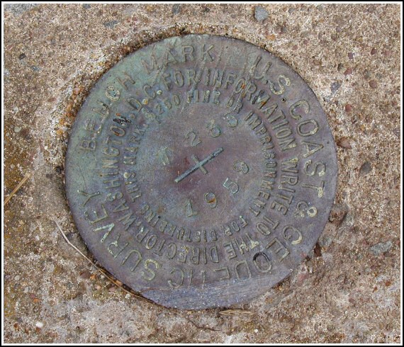
| Type | Bench Mark Disk |
| Setting | Concrete Culvert |
| Monumented | 1959 by NGS |
| Description (NGS) | NGS Datasheet |
Narrative and photographs
This culvert was my final stop on a day of hunting benchmarks with Rich in NEPA. While certainly less interesting than nearby LY2680, this mark was a welcome easy find after that ordeal. We found two similar culverts in the area just south of Route 6 and west of Route 402; the mark is located on the one closer to the junction of Routes 6 and 402. The mark is in good condition, somewhat worn but with legible stamping. The description is accurate except that the Cedar Rest Drive Inn is no longer in operation.


N 41° 25.774’ W 075° 08.324’
This vertical control station is located on the center top surface of a concrete culvert headwall along the south side of Rt. 6 and roughly 250 feet west of the intersection of Rt. 402. The historical description leads reliably to the station, the mark is well exposed and was easy to find. At the station mark a Garmin GPSmap76 receiver indicated 130 feet from the scaled NGS datasheet coordinates. The disk is in good condition and the stamped designation is legible. ~Rich in NEPA~

