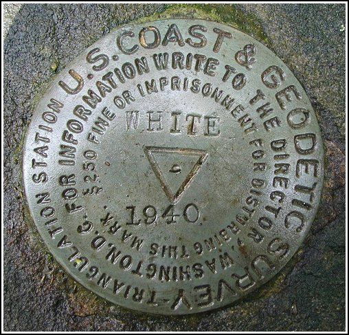
WHITE (LY2680)
WHITE
Spatial/elevation data
| Coordinates | N 41.415014° W 75.134374° |
| Elevation | 1650 ft. |
| Location | Pennsylvania
Pike County Hawley Quad |
Mark description
| Type | Triangulation Station Disk |
| Setting | Rock Outcrop |
| Monumented | 1940 by NGS |
| Description (NGS) | NGS Datasheet |
NGS recovery information
Descriptive text
The station, reference marks and azimuth mark were recovered in good condition. The rock cairn no longer exists. The station can be reached from the junction of PA Route 402 and U.S. Route 6 as follows. Travel south along Route 402 for 1.3 miles to a road left. Turn left onto Lake Shore Drive and follow this road southeast, keeping left at the y-fork, then northeast, for a total of 0.5 mile. Pack northward along a property boundary for approximately 0.34 mile to the station.Narrative and photographs
Note: this search is not recommended on hot, humid days! Recovering this station and its associated marks was the main goal of our Sunday afternoon adventures, and it became quite a challenge. The hike to the station mark was pleasant. Along the way we noticed many colorful mushrooms, some of which Rich was pretty sure were good to eat (though for some reason, he didn’t want to try one). Once we neared the top of the knoll, though, things got ugly. There was scrub oak as far as the eye could see, and hiding somewhere in the thicket was the station mark! We zeroed in on the station quite easily using the listed coordinates (no rock cairn remains in the area), and fought our way to it. But we had great difficulty locating the reference marks. The directions given were only approximate (as we later discovered), and walking was arduous due to the heavy brush. We stumbled around for well over an hour, examining every protrusion that could possibly have been described as an “outcrop”, until providentially we spotted RM 2 poking through the leaves. Not long afterward, I finally found RM 1 nearly flush against the ground and mostly covered by leaves. After paying our respects to this mark, we returned to the pull-off on the west side of Route 402 where we’d parked to locate LY1230, and searched for the azimuth mark. This mark was easy to locate and, like the other three marks in the set, was in excellent condition with the date and designation legible. Thanks, R, for providing the precise technical details!

To reach this first order horizontal control station required a cross-country hike of approximately 1/3 mile. We parked just off the edge of Lake Shore Drive at N41°24.625’ W075°07.970’ and began the approach by following a property boundary. The terrain is slightly uphill, moderately rocky, and for the most part open woods until the last several hundred feet where the brush thickens and impedes navigation. The historic description for this station indicates only the coarse directions to the reference marks, and due to the heavy growth finding them was a challenge. I estimate RM1 and RM2 to be 70 feet east and 44 feet southwest from the station mark, respectively. The 4-foot rock cairn was not found. An azimuth mark, located 3.42 miles to the west-northwest and just off the west side of Rt. 402 was very easy to find using the original description. (It is just south of the trail road and roughly 196 feet south-southwest from where station LY1230 is located.) At the station mark a Garmin GPSmap76 receiver indicated 0.0 feet from the adjusted NGS datasheet coordinates. All disks are in excellent condition, fully exposed, and the stamped designations are legible. ~Rich in NEPA~


| Designation | Status | Condition | Image |
|---|---|---|---|
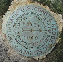
| WHITE AZ MK | Recovered | Good |
|
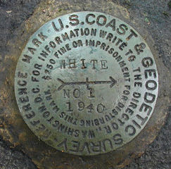
| WHITE RM 1 | Recovered | Good |
|
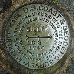
| WHITE RM 2 | Recovered | Good |
|