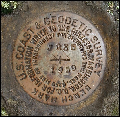
J 235 (LY1230)
J 235
Spatial/elevation data
| Coordinates | N 41.41725° W 75.140466° |
| Elevation | 1498.57 ft. |
| Location | Pennsylvania
Pike County Hawley Quad |
Mark description
| Type | Bench Mark Disk |
| Setting | Boulder |
| Monumented | 1959 by NGS |
| Description (NGS) | NGS Datasheet |
Narrative and photographs
This mark was another easy find. We found convenient parking off Route 402 at the intersection with a gravel road that, according to descriptions, was once a road to a stone quarry and later to a garbage dump, but now is State Forest property. The boulder was large enough that it couldn’t be missed (even by us), and it took us only a few seconds to spot the mark. The disk is in pristine condition — it looks like it was placed yesterday. The description was adequate to locate the mark.

N 41° 25.035’ W 075° 08.428’
This vertical control station is located on the top surface of a large outcropping boulder along and on the west side of Rt. 402. The historical description leads reliably to the station, the mark is well exposed and was easy to find. There is a large wooden sign marking the entrance of the trail road leading west and to a parking area. At the station mark a Garmin GPSmap76 receiver indicated 206 feet from the scaled NGS datasheet coordinates. The disk is in very good condition and the stamped designation is legible. ~Rich in NEPA~


