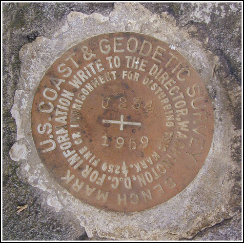
U 234 (LY1165)
U 234
Spatial/elevation data
| Coordinates | N 41.32375° W 75.204066° |
| Elevation | 1773.70 ft. |
| Location | Pennsylvania
Pike County Promised Land Quad |
Mark description
| Type | Bench Mark Disk |
| Setting | Boulder |
| Monumented | 1959 by NGS |
| Description (NGS) | NGS Datasheet |
NGS recovery information
Descriptive text
Recovered in good condition.Narrative and photographs
On a bitter cold, but pleasantly still and partly sunny day, Rich and I began our benchmark hunting in Promised Land with this mark. Even with a bit of snow on the ground, it was an easy find on a large boulder about 50 yards west of the parking area for the Rock Oak Trail in Promised Land State Park; the historic description leads directly to the mark and needs no updating. The disk is in good condition with both the date and designation legible.


Recovered in good condition.
This second order vertical control station is set in the top of an outcropping boulder roughly 50 yards west of a small parking area at the start of Rock Oak Trail. The historical description leads reliably to the station. At the station a Garmin GPSmap76 receiver with remote active antenna was used to record WAAS-corrected coordinates which were 41 feet from the scaled coordinates listed in the NGS datasheet. The mark is well exposed, in good condition, and the stamped designation is legible. ~Rich in NEPA~


