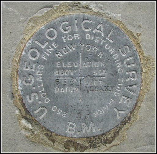
538 (LY0515)
538
Recovered in Good Condition on October 30, 2004
Spatial/elevation data
| Coordinates | N 41.258166° W 74.3586° |
| Elevation | 537.18 ft. |
| Location | New York
Orange County Warwick Quad |
Mark description
| Type | Bench Mark Disk |
| Setting | Stone Foundation |
| Monumented | 1903 by USGS |
| Description (NGS) | NGS Datasheet |
NGS recovery information
Descriptive text
Recovered in good condition. The Methodist Church is now the Clocktower Building. Autonomous (non-corrected) handheld GPS coordinates for the station are 41 15 29.40(N) 074 21 30.96(W).Narrative and photographs
I was in Warwick for a day of wine-tasting and touring the countryside with my parents. I happened to notice this mark while we were stopped on Main Street. My father was willing to pull over into the adjacent parking lot, and he even came along with me as I recorded the coordinates and took my photos. The disk is in good condition, especially for such an old mark. This building has made a neat transformation from an old church into commercial space; it now houses a video store and antique market, among other businesses.


