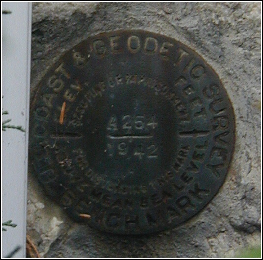
A 254 (LY0214)
A 254
Recovered in Good Condition on October 30, 2004
Spatial/elevation data
| Coordinates | N 41.617916° W 74.316116° |
| Elevation | 438.24 ft. |
| Location | New York
Ulster County Pine Bush Quad |
Mark description
| Type | Bench Mark Disk |
| Setting | Stone Foundation |
| Monumented | 1942 by NGS |
| Description (NGS) | NGS Datasheet |
NGS recovery information
Descriptive text
Recovered in good condition. Autonomous (non-corrected) handheld GPS coordinates for the station are 41 37 4.50(N) 074 18 58.02(W).Narrative and photographs
This mark was our third and final find of the day. My father again assisted in the search, and we quickly spotted the mark set in the stone foundation at the southwest corner of the church. It is concealed by shrubbery and is set behind a flower bed, making it difficult to get a close-up photo. The disk is in good condition, and no changes to the original description are necessary.


