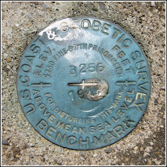
B 256 (LY0177)
B 256
Recovered in Good Condition on May 31, 2009
Spatial/elevation data
| Coordinates | N 41.677133° W 74.215533° |
| Elevation | 265.78 ft. |
| Location | New York
Ulster County Gardiner Quad |
Mark description
| Type | Bench Mark Disk |
| Setting | Concrete Post |
| Monumented | 1942 by NGS |
| Description (NGS) | NGS Datasheet |
NGS recovery information
Descriptive text
Station recovered in good condition. The house, fence, and reference post mentioned in the description were not found. Autonomous (non-corrected) handheld GPS coordinates for the station are 41 40 37.7(N) 074 12 55.9(W).Narrative and photographs
We decided to follow our GPS’s directions today, and so we ended up taking a slightly different route than usual to New Paltz. We turned east off Route 209 near Cuddebackville onto Route 211, which we followed through Otisville and Howells before heading northeast. This mark, on Bruynswick Road, was along our route. It was an easy find because the post projects prominently above the grassy shoulder of the road. The reference objects from the description were not found.


