MT PENN LOOKOUT TOWER
Spatial/elevation data
| Coordinates | N 40.347258° W 75.902401° |
| Elevation | Unknown |
| Location | Pennsylvania
Berks County Reading Quad |
Mark description
| Type | Landmark/Intersection Station |
| Setting | Tower |
| Monumented | 1942 by NGS |
| Description (NGS) | NGS Datasheet |
NGS recovery information
Descriptive text
Recovered in good condition.Narrative and photographs
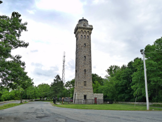
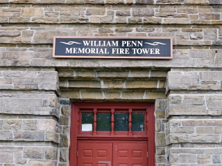
This tower was built as a fire lookout tower, a replacement for the original fire tower (visible in old postcards—see KV3830) that burned down in 1923. The current tower opened in 1939 and served for nearly 49 years until it was taken out of active use in 1988. Minimal maintenance kept the tower standing, but the interior deteriorated. Restoration efforts began in 2000, and since 2004 the tower has been open to visitors on a limited basis. It is in good condition and there is no indication that the exterior of the tower has been damaged or modified in any way.
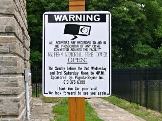
The sign indicates that the tower is occasionally open for visitors to climb the 120 steps to the top, but it was closed today. (Someone really should have proofread their sign, by the way.)


