MARYLAND 465 BALTO USGS (JV1174)
MARYLAND 465 BALTO USGS
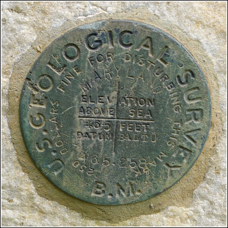
Spatial/elevation data
| Coordinates | N 39.400236° W 76.606124° |
| Elevation | 464.52 ft. |
| Location | Maryland
Baltimore County Towson Quad |
Mark description
| Type | Bench Mark Disk |
| Setting | Stone Foundation |
| Monumented | 1902 by USGS |
| Description (NGS) | NGS Datasheet |
NGS recovery information
Descriptive text
Recovered in good condition as described.Narrative and photographs
Kristen and I were in Towson for a CONTENTdm conference. We were both exhausted after sitting through several presentations, so we decided to skip the reception and go off on our own. Kristen did some shopping and I, of course, seized the opportunity to search for a few benchmarks!
This mark lies outside of the radius I had originally intended to walk, but I had plenty of time left after finding the tri-station TOWSON, so I couldn’t resist. I was particularly interested in this old mark, anyway—it’s an early USGS disk from the same era as the turn-of-the-(20th) century Albany survey. We’ve found a few of those disks in the past.
The description from Results of Spirit Leveling in Maryland, 1896 to 1911, inclusive. USGS, 1914 is as follows:
Towson, on southeast cornerstone of courthouse porch; bronze tablet
stamped “465 Balto”__________________________ 465.221
The heavy shower that soaked me while I was recovering TOWSON let up on my way to the courthouse. As expected, this was an easy find, after which I sat on one of the many (wet) benches in the surrounding park and called Rich to give him an update on my day (and of course, on the benchmark recoveries!). The disk is in excellent condition. No date is stamped on the disk, but the official description indicates that the date of monumentation was 1902.

