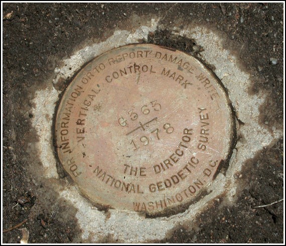
G 363 (KV2898)
G 363
Spatial/elevation data
| Coordinates | N 40.792033° W 75.264166° |
| Elevation | 446 ft. |
| Location | Pennsylvania
Northampton County Wind Gap Quad |
Mark description
| Type | Bench Mark Disk |
| Setting | Bridge Abutment |
| Monumented | 1978 by NGS |
| Description (NGS) | NGS Datasheet |
Narrative and photographs
G 363 was recovered as part of a day-long mountain biking, geocaching and benchmark hunting excursion! We rode over to the Plainfield Township Rail-Trail from nearby Jacobsburg State Park to continue our adventures. Along the trail, we stopped to recover this mark set in the northwest abutment of an old steel railroad bridge. It took a lot of work to dig through the debris (mostly mud and weeds) concealing the corner of the abutment, but when we did, we found the benchmark disk in excellent condition.


N 40° 47.522’ W 075° 15.850’
Recovered in good condition.
This first order vertical control station is set in the top surface of the northwest abutment of an old steel girder railroad bridge across Little Bushkill Creek. The historical description leads somewhat reliably to the station, except that Rt. 191 has been rerouted further north to a new overpass across the railroad and the creek. The former railroad bed has been converted to the Plainfield Township Rails-Trail. The station is roughly 550 feet south of the overpass, 220 feet south-souhtwest of powerpole BTCO of PA #264, and 8 feet west of the centerline of the trail. At the station a Garmin GPSmap76 receiver with remote active antenna was used to record WAAS-corrected coordinates which were 133.8 feet from the scaled coordinates listed in the NGS datasheet. The mark was found buried under a few inches of dirt, gravel and plant roots. It is now well exposed, in good condition, and the stamped designation is legible. ~Rich in NEPA~


