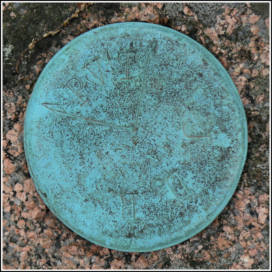
JDR/PVT
JDR/PVT
Spatial/elevation data
| Coordinates | N 44.320533° W 68.198283° |
| Elevation | Unknown |
| Location | Maine
Hancock County Seal Harbor Quad |
Mark description
| Type | Boundary Monument |
| Setting | Granite Monument |
| Monumented | Unknown by Unknown Agency |
Narrative and photographs
This morning was wet and chilly, and after breakfast we had very little motivation to do much of anything. After a few hours, though, conditions started to improve, and we hiked the Jordan Pond Trail as our main activity for the day. Then, still searching for some inspiration, we decided to drive around and recover a few of the boundary monuments we had already spotted from the road but hadn’t stopped to photograph.
The final one for the day was what we’re calling JDR/PVT due to the stamping on the disk (we assume this indicated a boundary between private land and that of JDR, Jr.). This disk is set in the top of a pink granite monument marked by an adjacent orange NPS witness post. Both the disk and monument appear to be in good condition. The mark is set on a park boundary line on the eastern side of Otter Cliff Road. Although we did quite well recovering four of these boundary monuments today, I’m sure there are many more to locate!

