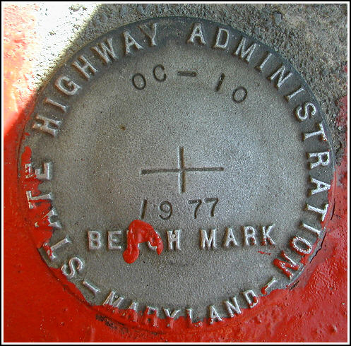
OC 10 (HU1168)
OC 10
Recovered in Good Condition on September 5, 2003
Spatial/elevation data
| Coordinates | N 38.359° W 75.082983° |
| Elevation | 4.58 ft. |
| Location | Maryland
Worcester County Ocean City Quad |
Mark description
| Type | Bench Mark Disk |
| Setting | Concrete Base |
| Monumented | 1977 by MDDOT |
| Description (NGS) | NGS Datasheet |
Narrative and photographs
This survey disk was found as described in the base of a street light just south of Eagle Drive. The mark was located easily using the historic description. The mark lies just northeast of the northeast corner of the parking lot for “The Carvinelle” apartments. At the site, I recorded coordinates that are approximately 172 feet from the coordinates given on the datasheet. The disk is in very good condition with all stamping clearly legible.
