OC 5 (HU1163)
OC 5
Recovered in Good Condition on September 5, 2003
Spatial/elevation data
| Coordinates | N 38.394833° W 75.063266° |
| Elevation | 9.62 ft. |
| Location | Maryland
Worcester County Assawoman Bay Quad |
Mark description
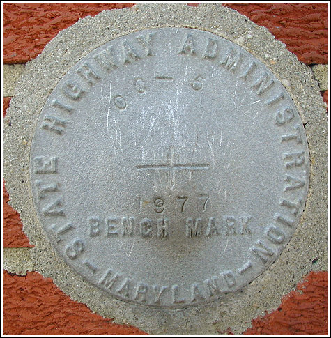
| Type | Bench Mark Disk |
| Setting | Brick Wall |
| Monumented | 1977 by MDDOT |
| Description (NGS) | NGS Datasheet |
Narrative and photographs
This Maryland State Highway Administration survey disk was found easily using the historic description; no changes are necessary. At the site my Garmin eTrex receiver recorded coordinates that were 48.7 feet from the scaled coordinates listed on the datasheet. The disk is in good condition with legible stamping. A firefighter took an interest in what I was searching for and allowed me to poke around inside the firehouse as well.
