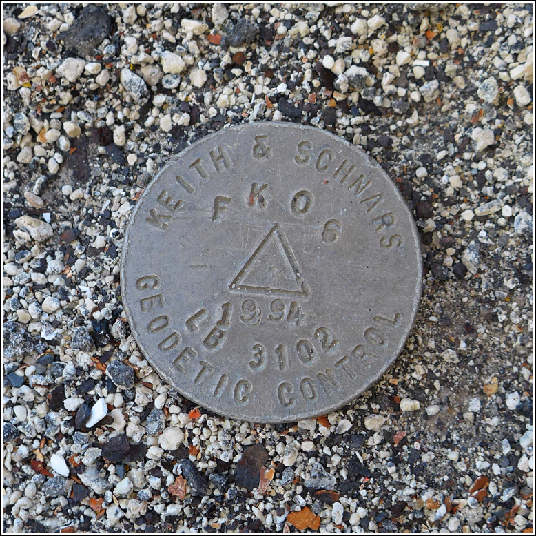
FK06 LB 3102
FK06 LB 3102
Recovered in Good Condition on February 20, 2016
Spatial/elevation data
| Coordinates | N 24.705325° W 81.145178° |
| Elevation | Unknown |
| Location | Florida
Monroe County Sevenmile Bridge Quad |
Mark description
| Type | Geodetic Control Survey Disk |
| Setting | Bridge Bannister |
| Monumented | 1994 by Keith & Schnars |
Narrative and photographs
After a fun lunch at the Sunset Grille at the eastern end of the Seven Mile Bridges, we decided to work off our oysters and Guinness with a walk along the old bridge toward Pigeon Key. Despite horribly strong winds and the fact that I had to pee almost the entire way, we made it to Pigeon Key and back, and enjoyed every step. And along the way, we spotted this little disk that we had somehow missed before! It’s a geodetic control disk set by a local firm whose recoveries we’ve seen for other marks in the NGS database (such as BUNCH). The disk is set along the southern edge of the bridge (in the deck, not the curb) about two-thirds of the way from Knights Key to Pigeon Key.

