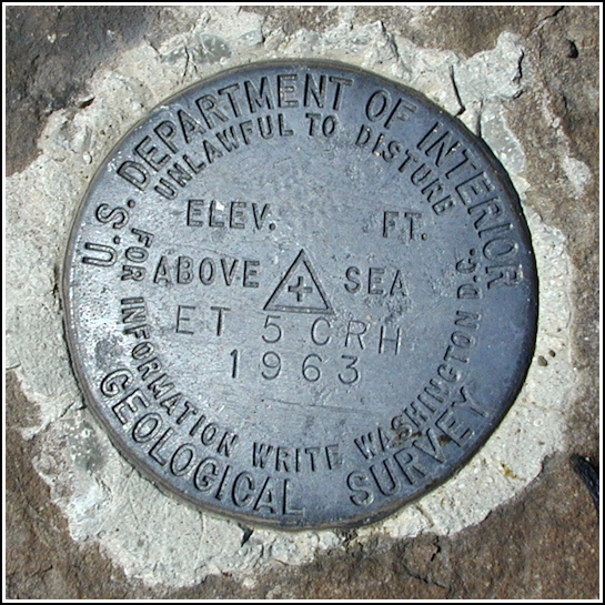
ET 5 CRH
ET 5 CRH
Recovered in Good Condition on May 30, 2005
Spatial/elevation data
| Coordinates | N 41.129716° W 75.739716° |
| Elevation | Unknown |
| Location | Pennsylvania
Luzerne County Stoddartsville Quad |
Mark description
| Type | Electronic Traverse Station Disk | ||||||
| Setting | Bedrock | ||||||
| Monumented | 1963 by USGS | ||||||
| Description (USGS) | White Haven, 0.2 mi W. of RR. station, along U.S. Highway 940 to Church Street, thence 4.4 mi right along Church Street and County Road 40041 to underpass of Pennsylvania Turnpike (NE. extension), continue 2.0 mi along Road 40041 to entrance to Bear Creek Dam, thence left along field rd. (passing through locked chain across rd.) and continue to top of hill and and borrow pit for dam fill; 100 ft S. of fence; in large stone flush with ground; standard tablet stamped “ET 5 CRH 1963”
|
USGS recovery information
View reportNarrative and photographs
This horizontal control station is conveniently located along the trail to On the Roost, so even though Aaron was with us, there was simply no way Rich and I could resist recovering this mark. Fortunately, it didn’t take long! The mark is in excellent condition and right out in the open along a field road as described, the only difference being that the fence just north of the mark has been removed. This mark is located just outside the boundary of SGL #119.


