106 DOR USGS (DW1094)
106 DOR USGS
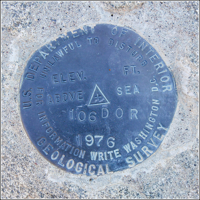
Spatial/elevation data
| Coordinates | N 33.716638° W 115.808666° |
| Elevation | 2556.53 ft. |
| Location | California
Riverside County Cottonwood Spring Quad |
Mark description
| Type | Bench Mark Disk |
| Setting | Rock Outcrop |
| Monumented | 1976 by USGS |
| Description (NGS) | NGS Datasheet |
NGS recovery information
Descriptive text
Recovered in good condition. Gravity disks ‘PBB 17 1976’ and ‘PBB 17A 1976 +.101’ were also found as described, in good condition.Narrative and photographs
Today was our only full day to explore Joshua Tree National Park, and we enjoyed a variety of activities including photography, hiking, and hunting for a particular species of cholla cactus. But of course, it wouldn’t be a vacation day for us if it didn’t also include benchmark hunting! We wanted to see if we could find a particular USGS disk with scaled coordinates that was just a few miles north of the entrance.
Scaled coordinates don’t usually give us much confidence, but the description sounded detailed enough to be useful. What was particularly interesting about this disk was that there were supposedly two gravity stations nearby as well! One was supposedly adjacent to the primary benchmark and the other was 65 feet to the south. We parked at the nearest possible spot to the scaled coordinates and hiked in toward the “NORTH END OF AN OUTCROP WITH BLACK DESERT TARNISH,” not expecting much. But it only took a minute of walking up a wash/ditch to spot the two disks set just inches apart on an outcropping boulder! Rich paced off 65 feet to the south and immediately we spotted the other gravity disk. The gravity disks are shaped like hexagons. All three marks appear to be in good condition.
 on boulder")

