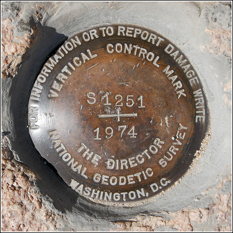
S 1251 (DX3350)
S 1251
Recovered in Good Condition on March 30, 2019
Spatial/elevation data
| Coordinates | N 33.9805° W 116.013888° |
| Elevation | 3749.25 ft. |
| Location | California
Riverside County Malapai Hill Quad |
Mark description
| Type | Vertical Control Mark |
| Setting | Boulder |
| Monumented | 1974 by NGS |
| Description (NGS) | NGS Datasheet |
NGS recovery information
Descriptive text
Recovered in good condition. The stub of the witness post is still evident, as noted in the 2004 recovery.Narrative and photographs
At one pulloff north of Cottonwood Spring, we noticed a neat rock ledge with what looked like the bottom few inches of a signpost embedded in it. My first thought, of course, was “witness post,” although I didn’t see a survey mark immediately nearby. But a moment later I turned around and, in a small depression in the rock, I spotted one! So cool! It’s always exciting when we find a mark serendipitously. The disk is in very good condition and the witness post, as mentioned, has been sheared off but the remaining piece of the signpost is still evident and easy to spot.


