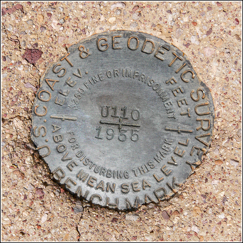
U 110 (DA0366)
U 110
Spatial/elevation data
| Coordinates | N 32.0855° W 112.7725° |
| Elevation | 1989.2 ft. |
| Location | Arizona
Pima County Tillotson Peak Quad |
Mark description
| Type | Bench Mark Disk |
| Setting | Square Concrete Monument |
| Monumented | 1935 by NGS |
| Description (NGS) | NGS Datasheet |
NGS recovery information
Descriptive text
Recovered in good condition. The old Ajo-Sonoyta Road is now a hiking trail accessible from Alamo Canyon Road to the north and Ajo Mountain Drive to the south. The witness post was not found.Narrative and photographs
During today’s “travel day” between Tucson and Ajo, we spent time recovering three triangulation stations along Route 86. Those adventures were exciting enough, but we weren’t done yet! On Rich’s suggestion, we drove to the northern end of the Old Ajo-Sonoyta Road for a short hike and to try to recover a few of the benchmarks that lie along this old road.
We parked at the registration area, where we saw a large cairn at the north end of a wide wash and another large cairn at the south side. It looked like this would be the beginning of the trail, and it was. We hiked south about a third of a mile to the first mark, U 110. The coordinates were quite good, so we walked right up to the mark. It was guarded by a young saguaro and is in excellent condition, although its witness post is gone.

