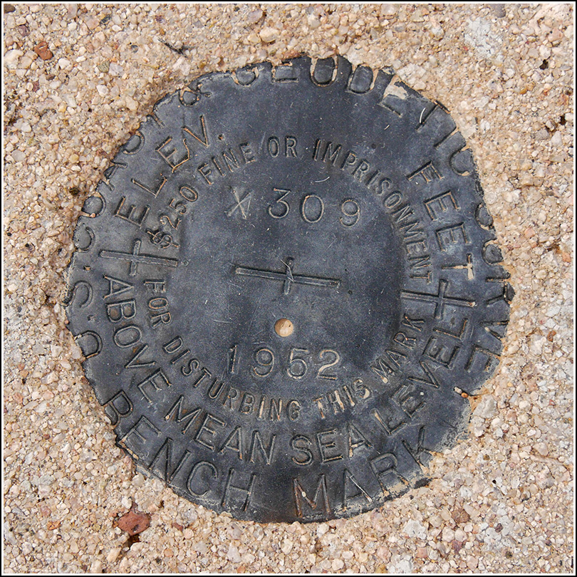
X 309 (DA0367)
X 309
Spatial/elevation data
| Coordinates | N 32.072972° W 112.776777° |
| Elevation | 1937.2 ft. |
| Location | Arizona
Pima County Tillotson Peak Quad |
Mark description
| Type | Bench Mark Disk |
| Setting | Round Concrete Monument |
| Monumented | 1952 by NGS |
| Description (NGS) | NGS Datasheet |
NGS recovery information
Descriptive text
Recovered in good condition. The old Ajo-Sonoyta Road is now a hiking trail accessible from Alamo Canyon Road to the north and Ajo Mountain Drive to the south. The witness post is no longer present.Narrative and photographs
After recovering U 110 along the old Ajo-Sonoyta Road, we continued on the relatively level, rocky, grass- and weed-covered road toward the next mark, X 309, about a mile south. Wildflowers lined the old road along this stretch; most of the flowers in this area were low-growing asters in various shades of lavender, and Mojave lupines.
Knowing that the coordinates for the second mark were scaled, we didn’t expect them to be very helpful, but we went directly toward them first just to give ourselves a starting point. There’s so much vegetation here that we had no chance of spotting the mark just by scanning the area, and as expected, the coordinates weren’t very accurate. So we decided to walk to the wash mentioned in the description and pace off the distance as specified on the datasheet, and then pace off the distance from the road. Rich was our pacer, and he couldn’t have been closer if he’d had a tape measure! His pacing took us directly to the mark—unbelievable! This mark was also in great condition, but as we found with U 110, its witness post is missing.


