PTOLEMY (AB3880)
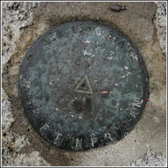
PTOLEMY
Spatial/elevation data
| Coordinates | N 41.311683° W 73.970667° |
| Elevation | 404 ft. |
| Location | New York
Westchester County Peekskill Quad |
Mark description
| Type | Survey Mark |
| Setting | Rock Outcrop |
| Monumented | 1995 by NYSDOT |
| Description (NGS) | NGS Datasheet |
NGS recovery information
Descriptive text
Recovered in good condition.Narrative and photographs
After a day of (mis)adventures in the rain at Rockefeller State Park Preserve, Rich and I stopped at an overlook along Route 6 for a view over the river. There was a brief break in the rain and we hoped to catch a glimpse of Bear Mountain and perhaps some activity on the water. When we peered over the stone wall, however, another interesting sight confronted us—a survey disk on the rock ledges below! We climbed down to it and discovered that it was PTOLEMY. Without a datasheet we weren’t sure if there were auxiliary marks to be found; our brief search revealed nothing. We (correctly) guessed that since the date of monumentation was so recent, this may well be a GPS station without a need for reference marks. The disk is in good, but weathered condition and is set as described.


