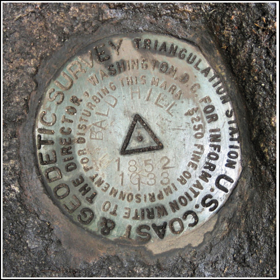
BALD HILL RESET (LX4439)
BALD HILL RESET
Recovered in Good Condition on June 10, 2006
Spatial/elevation data
| Coordinates | N 41.501616° W 73.917366° |
| Elevation | 1503 ft. |
| Location | New York
Dutchess County Wappingers Falls Quad |
Mark description
| Type | Triangulation Station Disk |
| Setting | Bedrock |
| Monumented | 1852 by NGS |
| Description (NGS) | NGS Datasheet |
NGS recovery information
Descriptive text
The station and all three reference marks were recovered in good condition on rock outcrops, as described. A drill hole was found in the outcrop near RM 3, but no attempt was made to match its location to the descriptions of drill holes provided in earlier recovery notes. After the recovery was made, rocks were again put in place over the station mark to return it to the same condition it was in when found. The station is near the high point of Bald Hill in the Fishkill Ridge Conservation Area. It can be reached via the Fishkill Ridge Trail. Handheld GPS coordinates for RM 1 are 41 30 05.8(N) 073 55 01.7(W). Handheld GPS coordinates for RM 2 are 41 30 06.3(N) 073 55 02.3(W). Handheld GPS coordinates for RM 3 are 41 30 06.0(N) 073 55 02.8(W).Narrative and photographs
This station has quite an interesting, and confusing, history. The 1938 recovery makes mention of setting an azimuth mark, which is not referred to anywhere else on the datasheet. This same recovery also mentions an “old azimuth not visible due to heavy growth of brush and timber” and it’s not clear what this referred to, either.


| Designation | Status | Condition | Image |
|---|---|---|---|
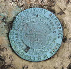
| BALD HILL RESET RM 1 | Recovered | Good |
|
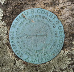
| BALD HILL RESET RM 2 | Recovered | Good |
|
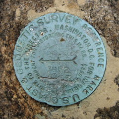
| BALD HILL RESET RM 3 | Recovered | Good |
|